
Fail:Hill in the north-east part of Jos, Nigeria (15).jpg

Shi nwuana̱son huni:a̱yaapixel 800 × 532 Ngyong ghyáng: a̱yaapixel 320 × 213 | a̱yaapixel 640 × 426 | a̱yaapixel 1,024 × 681 | a̱yaapixel 1,280 × 851 | a̱yaapixel 3,008 × 2,000.
A̱tsatsak fail (A̱yaapixel 3,008 × 2,000, shi fail: 2.65 MB, kak MIME: image/jpeg)
.jpg)
Nam-a̱lyiat
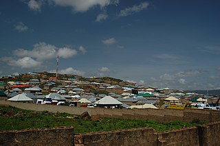
| Wa̱i a̱lyiat | View near University Junction |
| A̱tuk | |
| A̱tyin | Ta̱m a̱pyia̱ nung hwa |
| A̱tyulyuut | Jiří Komárek |
| Camera location | | View this and other nearby images on: OpenStreetMap |
|---|
.jpg¶ms=009.958550_N_0008.890626_E_globe:Earth_type:camera__&language=kcg)
Shyiat kwaa̱mbwat a̱ka̱wat
I, the copyright holder of this work, hereby publish it under the following license:
This file is licensed under the Creative Commons Attribution-Share Alike 4.0 International license.
- A byia̱ sa̱t:
- ka̱ a cat ka̱u – ka̱ a cat maat, ka̱u ma̱ng shei ta̱m hu
- ka̱ a cat nyia̱ ri̱mik – ka̱ a cat saai ta̱m hu
- A̱tafa ta̱fwat ji̱ khwi a̱ni:
- a̱di̱dam kaswuo – Ta hwa a nwuak a̱gwai ku myim a̱ni, tyia̱ a̱fwuop kwaa̱mbwat a̱ka̱wat ka, a si̱ wa̱i ka̱ á̱ ku shai kyang mami. A bye nyia̱ a̱nia di̱ kuzang za̱kwa ji̱ myim a̱ni, a̱wot tyong nyian hu si̱sak ji̱ na li á ngyei a̱tyunwuat kwaa̱mbwat a̱ka̱wat wu wa shim ang ku da̱ nggu wa shim nyian ta̱m ang hu a̱ni.
- ka̱u mameang – Ka̱ a nyia̱ ri̱mik, shai, ku a nok tazwa a̱ngga wu, ta hwa a ka̱u jhyet ang ji a̱tafa kwaa̱mbwat a̱ka̱wat ku yet kyang nyiung ku si̱ ku myim a̱ni nang a̱tsak wu.

I. Licence
.jpg)
In printed material: Photo: © Jiří Komárek, JiriKomarek.net, Licence: Creative Commons BY-SA 4.0 (URL: https://creativecommons.org/licenses/by/4.0/legalcode), Source: Wikimedia Commons
The author of this picture, Jiří Komárek, published this file under the Creative Commons Licence Attribution-ShareAlike 4.0. The image can be used freely under the license, as long as the author is mentioned in the following form in the caption or for printed products in the image credits: © Jiří Komárek, JiriKomarek.net, CC BY-SA 4.0.
It is also necessary to provide a copy of the license or at least its full Internet address (https://creativecommons.org/licenses/by/4.0/legalcode). In online media is in use in addition to the aforementioned copyright and license specifying a reference (link) to put on the original image - so this page with descriptions and license conditions. For more information or examples of use can be found at re-use (with example file). Modifications have to be declared as such.
If you need another license to use or a different resolution, so please contact the author before using.
From printed materials and other tangible products that use that work, the user is asked to send a copy to the author. The mailing address can be requested via the contact options.
In the case of a breach of the license conditions, the rights granted hereunder will expire automatically. The author reserves the right in this case to assert injunctive relief and damages.
II. Disclaimer
It is possible that third parties are to be considered for example in case of trademark, design or personality rights. You are responsible to check and respect these rights in the publication in the respective medium or country.
Please note the General disclaimer.
III. Contact
E-mail me to JiriKomarek.net@gmail.com or visit the author's website

Please do not upload an updated image here without consultation with the author. The author would like to make corrections only at his own source.
Nkhang fail
Nyap a̱tuk/jen a nwuan fail hu ma̱nang ku ku ndi di̱ ntsa hu mi̱ di̱n jen a̱ja.
| A̱tuk/Jen | A̱gban ghwughwu | Shi-a̱ka̱ta̱m | A̱tyunta̱m | A̱di̱dam | |
|---|---|---|---|---|---|
| mi̱ di̱ yong huni | 20:58, 9 Zwat Jhyiung 2020 | | 3,008 × 2,000 (2.65 MB) | Jiří Komárek | VicuñaUploader 1.23 |
Nyian ta̱m ma̱ng fail
Wat huni nyia̱ ta̱m ma̱ng fail huni:
Nyian ta̱m ma̱ng fail mi̱ swanta hu a̱mgba̱m
A̱yaawuki á̱ghyang bani nyia̱ ta̱m ma̱ng fail huni:
.jpg)